
Maps
 The following maps were generated by the Nashua Regional Planning Commission (NRPC) using their Graphic Information System (GIS). The information depicted on the maps is a composite from SFC Engineering Partnership Inc. 1999, NRPC GIS efforts, USGS efforts and the UNH GRANIT program. Not all information is 100% up to date and current, therefore should not be construed as complete, up-to-date or used for surveying purposes. Its only intended purpose is for general reference.
Please note that our previous maps were discovered to have some scaling issues which caused some properties map sheet to be renumbered to where the predominate amount of the lot resides. The current map and lot numbers should be confirmed prior to submitting any applications, plans, etc. Click here for a list of all affected properties.
2018 Pelham's Open Space Lands This map shows Town & State owned properties conserved as open space.
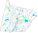
2018 Pelham Street Index & Addresses Map |
| 2015 Pelham Zoning Map |
| 2006 Trail Map This map shows Recreational Trails Inventory as of 2006 |
| 2008 Conservation Map Showing conserved land as well as wetlands. |
Time Saving Tip
If your going to save the file to your local PC, place your cursor over the file link and RIGHT mouse click, then select "Save Target As..." This will save you the time of downloading the file twice, once when you would normally click on it to view it, and a second time when you would normally save it. Once the file is on your local PC, you can view, print and manipulate it with faster performance.